


-75x75.png "GEOSUN")
-75x75w.png "Skyland X")


-300x300.png)


-250x250.png "Geosun GS-200G")
-250x250.png "Geosun GS-200G")
%20(1)-250x250.png "GOSLAM M40 RTK")
-250x250.png "GOSLAM M40 RTK")


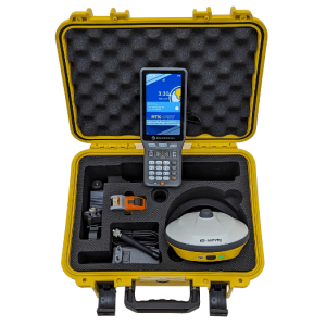
-250x250.png "RECAP PACER X - Full Rover Set")


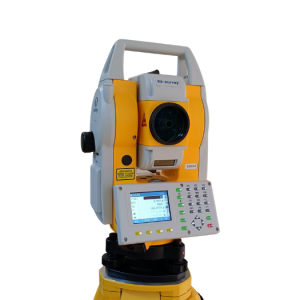
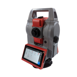
-250x250.png "a-GEO AlphaY Γεωδαιτικός σταθμός 2''")
-250x250.png "a-GEO AlphaY Γεωδαιτικός σταθμός 2''")
-250x250.png "STEC AXIS 2")
-250x250.png "STEC AXIS 2")
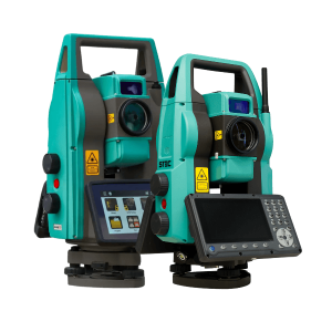
-250x250.png "STEC AXIS 9 - ANDROID TS")
-250x250.png "STEC AXIS 9 - ANDROID TS")


-250x250.jpg "1000 Σημαίες σήμανσης 21 inch (53.3cm)")
-250x250.jpg "1000 Σημαίες σήμανσης 21 inch (53.3cm)")
-250x250.png "SW-DG100 Διπλής κατεύθυνσης αποστασιόμετρο με πράσινο Laser")
-250x250.png "SW-DG100 Διπλής κατεύθυνσης αποστασιόμετρο με πράσινο Laser")


-250x250.png "RTM-AL Ενισχυμένος τρίποδας αλουμινίου RECAP Dual Lock")
-250x250.png "RP250-2C Πτυσσόμενος στυλεός ανθρακονημάτων RECAP 2.50μ")
-250x250.png "RP250-2C Πτυσσόμενος στυλεός ανθρακονημάτων RECAP 2.50μ")


-250x250.png "Μεταχειρισμένος δέκτης RTK e-survey E600")
-250x250.png "Μεταχειρισμένος δέκτης RTK e-survey E600")
-500x500.png "Demo EasyScan M05")
-500x500.png "Demo EasyScan M05")
-500x500.png "Demo EasyScan M05")
-500x500.png "Demo EasyScan M05")
-500x500.png "Demo EasyScan M05")
-500x500.png "Demo EasyScan M05")
-80x80.png "Demo EasyScan M05")
-80x80.png "Demo EasyScan M05")
-80x80.png "Demo EasyScan M05")
-80x80.png "Demo EasyScan M05")
-80x80.png "Demo EasyScan M05")
-80x80.png "Demo EasyScan M05")
 Messenger
 WhatsApp
 Τηλέφωνο
- Διαθεσιμότητα: Εξαντλήθηκε
- Μοντέλο: Demo EasyScan M05
- Βάρος: 3.00
- Διαστάσεις: 30.00 x 20.00 x 10.00


Άλλα προϊόντα του ίδιου κατασκευαστή
-60x60.png "EasyScan T05 Laser Scanner")
-60x60.png "EasyScan T10 Laser Scanner")
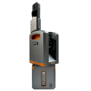
RECAP DEMO EasyScan M05
Ελαφρώς μεταχειρισμένος φορητός σαρωτής - χρησιμοποιήθηκε μόνο σε παρουσιάσεις!
Βρίσκεται σε άριστη κατάσταση!
Η τιμή αφορά μόνο το συγκεκριμένο τεμάχιο, και περιλαμβάνει την full premium version του EPiC Cloud Center!
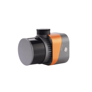
••► ± 2cm σχετική ακρίβεια
••► 90 λεπτά αυτονομία
••► Δυνατότηα αληθινού χρώματος νέφους σημείων (με μετεπεξεργασία)
••► Πανεύκολο στη χρήση!
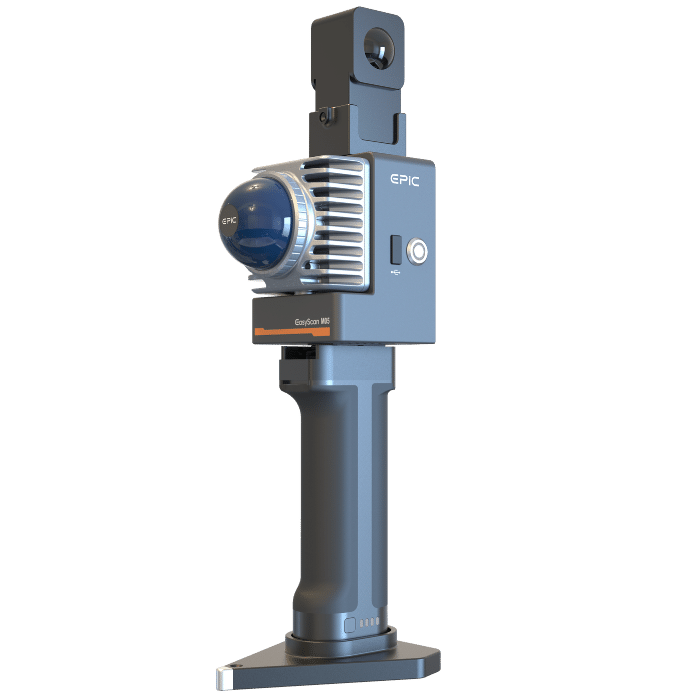
Το EasyScan M05 είναι μια φορητή συσκευή Laser Scanner (SLAM), ιδανική για γρήγορες 3D αποτυπώσεις εσωτερικών και εξωτερικών χώρων.
Η συμπαγής κατασκευή του το καθιστά εύκολο στη χρήση, ενώ παράλληλα η λαβή - μπαταρία του διαθέτει εργονομικό σχεδιασμό για εύκολο και σταθερό κράτημα κατά τη χρήση.
Μπορεί να χρησιμοποιξηθεί από οποιονδήποτε και δεν απαιτείται ιδιαίτερη εκπαίδευση.
EasyScan M05
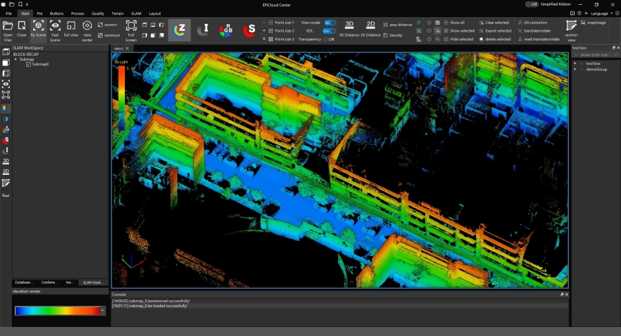
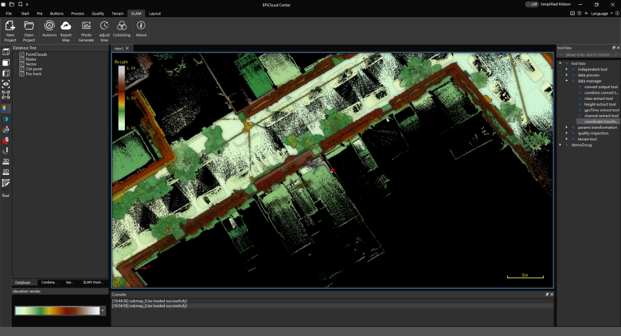
Η εφαρμογή πεδίου Easy Point Access σας επιτρέπει να προβάλλετε την πορεία σας στον χώρο, και να ελέγχετε διαρκώς τη λήψη δεδομένων. Μετά την ολοκλήρωση, τα δεδομένα εξάγονται στο USB stick, και εισάγονται στο λογισμικό SLAM Studio γιε επεξεργασία. Ως μέτρο σύγκρισης, ένα μεγάλο οικοδομικό τετράγωνο απαιτεί περίπου 8-10 λεπτά λήψης, και 10 λεπτά μετεπεξεργασίας σε έναν σχετικά απλό H/Y.
Η LIDAR τεχνολογία του επιτρέπει τις 16 ακτίνες λήψης να διαπερνούν εμπόδια και να αποτυπώνουν με ακρίβεια ακόμα και επιφάνειες οι οποίες δεν βρίσκονται σε άμεση προτεραιότητα. Θα παρατηρήσετε λοιπόν κατά την περιήγησή σας, πως αποτυπώνετε ακόμα και κατόψεις καταστημάτων από τα οποία απλά περνάτε από έξω.
Πλεονεκτήματα χρήσης EasyScan M05
- Ταχύτατη λήψης της πραγματικότητας σε 3D. Χρησιμοποιήστε το αποκλειστικά ή και συμπληρωματικά σε συνδυασμό με άλλες μεθόδους αποτύπωσης, και δημιουργήστε ψηφιακά υπόβαθρα και σημεία αναφοράς των εργασιών σας.
- Πλήρως κατάλληλο για εσωτερικούς και εξωτερικούς χώρους, συμπεριλαμβανομένων υπογείων, στοών, tunnel, εκσκαφών, δασών κτλ.
- Ιδανικό για άμεση καταγραφή - καταμέτρηση σημάτων, στύλων ΔΕΗ, καφάο, φρεατίων, δέντρων, κτλ
- Αποτελέι την πλέον οικονομική, αξιόπιστη και γρήγορη λύση, βάσει μεθοδολογίας.
- Εύκολη επεξεργασία και εξαγωγή point cloud σε las, laz, e57, xyz κ.α. για εργασία σε οποιοδήποτε λογισμικό
Ποιούς αφορά
- Τοπογράφους και πολιτικούς μηχανικούς για εσωτερικές - εξωτερικές αποτυπώσεις
- Αρχιτέκτονες και διακοσμητές για άμεση λήψη πληροφορίας εσωτερικών χώρων, γρήγορη επεξεργασία και δημιουργία όψεων, τομών κτ
- Επαγγελματίες του GIS για άμεση καταγραφή χαρακτηρισιτκών ενδιαφέροντος
- Δασολόγους / δασικούς για στοιχειοθέτηση τύπου βλάστησης, πυκνότητας, κατάστασης κτλ
- Χωματουργούς και εργολήπτες δημοσίων έργων για ογκομέτρηση, δημιουργία as-built κτλ
- Ασφαλιστικές εταιρείες για τεκμηριώσεις ατυχημάτων, ζημιών, αποτελεσμάτων φωτιάς κτλ
- Τεχνικές υπηρεσίες για επιθεωρήσεις έργων, καταγραφή εξέλιξης κατασκευής κτλ
Ενδεικτικές χρήσεις
- Τοπογραφικές αποτυπώσεις / GIS
- Ογκομέτρηση αποθέσεων
- Δημιουργία κατόψεων / όψεων / τομών κτηρίων
- Καταγραφή ατυχημάτων
- Επιθεώρηση ζημιών και καταστροφών
- Αποτυπώσεις υπογρίων χώρων & tunnel
- Καταγραφή & επιθεώρηση εναέριων καλωδίων
-250x250.png "Μεταχειρισμένος σαρωτής Laser STONEX X300")
-250x250.png "Μεταχειρισμένος σαρωτής Laser STONEX X300")
-250x250.png "EasyScan T05 Laser Scanner")
-250x250.png "EasyScan T05 Laser Scanner")
-250x250.png "EasyScan T10 Laser Scanner")
-250x250.png "EasyScan T10 Laser Scanner")
-250x250.png "Ashtech Promark 500 (μεταχειρισμένο)")
-250x250.png "Ashtech Promark 500 (μεταχειρισμένο)")


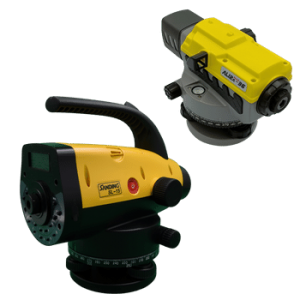
-250x250.png "Leica Sprinter 200M - ψηφιακός χωροβάτης")
-250x250.png "Leica Sprinter 200M - ψηφιακός χωροβάτης")
-250x250.png "PHANTOM 4 RTK Combo + D-RTK 2 Mobile Station (μεταχειρισμένο)")
-250x250.png "PHANTOM 4 RTK Combo + D-RTK 2 Mobile Station (μεταχειρισμένο)")