


-250x250.png "GOSLAM M40 - M40 RTK")

-250x250.png "EasyScan T05 Laser Scanner")
-250x250.png "EasyScan T05 Laser Scanner")
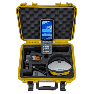


-250x250.png "a-GEO Matrix-II Laser RTK - Full Rover Set")

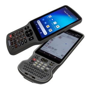
-250x250.png "S60III ανθεκτικό Android χειριστήριο 5.5 ιντσών")
-250x250.png "S60III ανθεκτικό Android χειριστήριο 5.5 ιντσών")
-250x250.png "P3 / S POD - Νέας γενιάς Android controller")
-250x250.png "P3 / S POD - Νέας γενιάς Android controller")
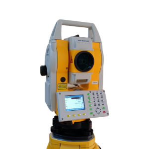
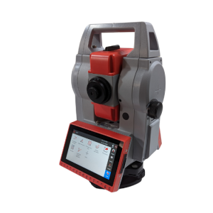
-250x250.png "Γεωδαιτικός σταθμός 2'' a-GEO Y")
-250x250.png "Γεωδαιτικός σταθμός 2'' a-GEO Y")


-250x250.jpg "1000 Σημαίες σήμανσης 21 inch (53.3cm)")
-250x250.jpg "1000 Σημαίες σήμανσης 21 inch (53.3cm)")


-250x250.png "Demo EasyScan M05")
-250x250.png "Demo EasyScan M05")


 Messenger
 WhatsApp
 Τηλέφωνο
- Διαθεσιμότητα: Σε απόθεμα
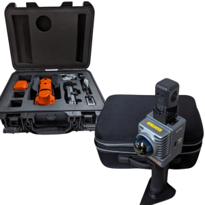
- Μοντέλο: Matrix VI
- Βάρος: 5.00
- Διαστάσεις: 40.00 x 30.00 x 20.00


Άλλα προϊόντα του ίδιου κατασκευαστή
-60x60.png "a-GEO L2 IMU RTK - Full Rover Set")

-60x60.png "a-GEO L300 - Full Rover Set")
-60x60.png "a-GEO Matrix II Lite - Full Rover Set")
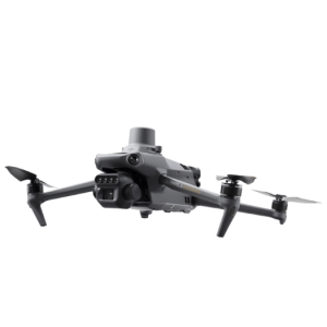
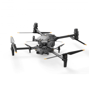
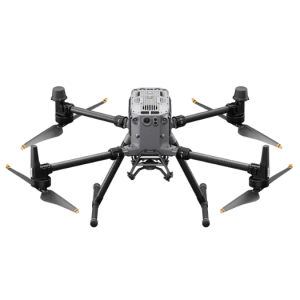
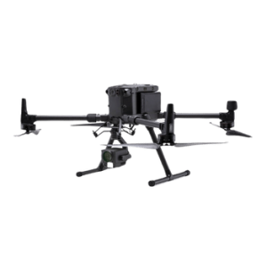
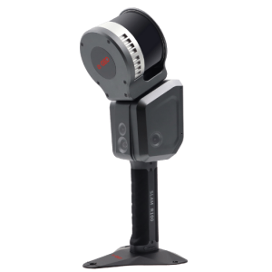
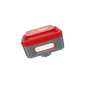
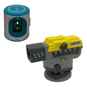
a-GEO Matrix VI
Visual Survey - LASER RTK - AR/VR GNSS receiver
Η Επόμενη Διάσταση στην Τοπογραφία
Ο a-GEO Matrix VI επαναπροσδιορίζει την τοπογραφία, συνδυάζοντας φωτογραμμετρική αποτύπωση, μέτρηση με EDM LASER και AR/VR χάραξη σε μία μόνο συσκευή. Ξεπερνώντας τους περιορισμούς των παραδοσιακών GNSS δεκτών, προσφέρει μια ολοκληρωμένη λύση για όλες τις μετρητικές εργασίες σας.
Ο συμπαγής all-in-one σχεδιασμός του εξασφαλίζει ανθεκτικότητα και ευελιξία σε απαιτητικά περιβάλλοντα, ενώ το μοντέρνο και διαισθητικό interface βελτιώνει την εμπειρία του χρήστη, καθιστώντας κάθε εργασία πιο γρήγορη, εύκολη και ακριβή.
Δείτε από την οπτική γωνία του Matrix VI
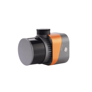
Ο Matrix VI ενσωματώνει Οπτική Αποτύπωση με προηγμένους φωτογραμμετρικούς αλγορίθμους, παρέχοντας μια εξαιρετικά παραγωγική και καινοτόμα λύση για τη μαζική καταγραφή και μέτρηση σημείων. Ξεπερνά τις δυνατότητες ενός συμβατικού RTK δέκτη, επιτρέποντας γρήγορες και ακριβείς μετρήσεις ακόμα και σε δύσκολες συνθήκες.
Συνδυάζοντας το RTK με την φωτογραμμετρική κάμερα του Matrix VI, μπορείτε να αποτυπώσετε ολόκληρες περιοχές – όπως ένα οικοδομικό τετράγωνο – με μια απλή σειρά εικόνων ή video. Από αυτά τα δεδομένα, προκύπτουν ακριβείς συντεταγμένες σημείων, είτε σε πραγματικό χρόνο στο πεδίο, είτε αργότερα στο γραφείο για περαιτέρω επεξεργασία.
Πέρα από τη φωτογραμμετρία, η κάμερα υποστηρίζει και τη μέτρηση με LASER. Σε έντονες συνθήκες φωτισμού, η δέσμη LASER μπορεί να μην είναι ορατή με γυμνό μάτι. Η κάμερα εξασφαλίζει οπτική επιβεβαίωση και επιτρέπει ακριβή στόχευση του επιθυμητού σημείου, ενισχύοντας την ακρίβεια και την αποδοτικότητα κάθε μέτρησης.
Αποτύπωση με απόλυτη ασφάλεια
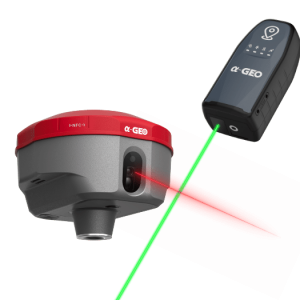
Το Matrix VI ενσωματώνει προηγμένη τεχνολογία μέτρησης με LASER, μειώνοντας σημαντικά τους κινδύνους στις τοπογραφικές εργασίες. Είτε βρίσκεστε δίπλα σε δρόμους με έντονη κυκλοφορία, κοντά σε πυλώνες υψηλής τάσης, είτε σε περιοχές με επικίνδυνο ή ασταθές έδαφος, μπορείτε να εκτελέσετε μετρήσεις από ασφαλή απόσταση, χωρίς να θυσιάζετε ακρίβεια και αξιοπιστία. Το LASER στοχεύει τα σημεία μέτρησης με απόλυτη ακρίβεια, χωρίς να απαιτείται φυσική προσέγγιση, διασφαλίζοντας έτσι τόσο την προστασία του χειριστή όσο και τη βελτιστοποίηση της διαδικασίας.
Και το πιο καινοτόμο χαρακτηριστικό; Δεν χρειάζεται στυλεός για τη χρήση του LASER! Τα Matrix VI και Matrix-II αλλάζουν τα δεδομένα, επιτρέποντας χειροκίνητη χρήση του δέκτη, χάρη στο πατενταρισμένο σύστημα IMU της a-GEO, καθιστώντας την αποτύπωση πιο ευέλικτη και αποδοτική από ποτέ.
Αποδοτική Χάραξη με AR και IMU
Η χάραξη σημείων στο έδαφος μπορεί να είναι χρονοβόρα και απαιτητική, ειδικά σε δύσκολα περιβάλλοντα με περιορισμένη κινητικότητα. Ο Matrix VI αλλάζει τα δεδομένα, αξιοποιώντας την AR (Augmented Reality) κάμερα και το υψηλής απόδοσης IMU σύστημα, κάνοντας τη διαδικασία γρήγορη, εύκολη και ακριβή.
Μέσα από ένα ενοποιημένο γραφικό περιβάλλον, προβάλλονται ταυτόχρονα οι οδηγίες πλοήγησης, η πραγματική εικόνα του χώρου και η CAD γραμμική πληροφορία, διευκολύνοντας τον εντοπισμό των σημείων ενδιαφέροντος και καθιστώντας τη χάραξη απλούστερη και πιο αποδοτική από ποτέ.
GNSS Δέκτης Υψηλής Απόδοσης
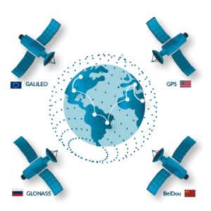
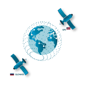
Ο Matrix VI προσφέρει ακρίβεια και αξιοπιστία σε κάθε τοπογραφική εργασία, χάρη στον ισχυρό αλγόριθμο παρακολούθησης σημάτων. Υποστηρίζοντας όλους τους δορυφορικούς σχηματισμούς (Full GNSS), εξασφαλίζει γρήγορη και σταθερή FIX λύση, ακόμα και σε απαιτητικά περιβάλλοντα. Η ενσωματωμένη τεχνολογία narrowband interference mitigation επιτρέπει ομαλή πλοήγηση σε πυκνά δάση ή αστικές περιοχές με ψηλά κτίρια, διατηρώντας υψηλή ακρίβεια σε κάθε μέτρηση.
Super IMU – Άμεση Ετοιμότητα, Χωρίς Καθυστερήσεις
Ο ταχείας αρχικοποίησης IMU αισθητήρας του Matrix VI δεν απαιτεί βαθμονόμηση και είναι ανθεκτικός σε μαγνητικές παρεμβολές, επιτρέποντας αξιόπιστες μετρήσεις χωρίς περιορισμούς στην κλίση. Με δυνατότητα μέτρησης έως 120°, μειώνει σημαντικά το χρόνο παραμονής στο πεδίο, κάνοντας κάθε εργασία ταχύτερη και πιο αποδοτική.

-250x250.png "e-Survey Alpha-2 RTK GNSS Rover")
-250x250.png "e-Survey Alpha-2 RTK GNSS Rover")
-250x250.png "a-GEO L1 Mini UHF RTK")
-250x250.png "a-GEO L1 Mini UHF RTK")
-250x250.png "a-GEO L2 IMU RTK GNSS Rover")
-250x250.png "a-GEO L2 IMU RTK GNSS Rover")


-250x250.png "e-Survey Alpha-2 IMU RTK GNSS Rover")
-250x250.jpg "e-Survey Alpha-2 IMU RTK GNSS Rover")
-250x250.png "a-GEO L2 IMU RTK - Full Rover Set")
-250x250.png "a-GEO L2 IMU RTK - Full Rover Set")
-250x250.png "a-GEO L300 - Full Rover Set")
-250x250.png "a-GEO L300 - Full Rover Set")
-250x250.png "a-GEO Matrix II Lite - Full Rover Set")
-250x250.png "a-GEO Matrix II Lite - Full Rover Set")