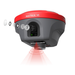
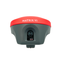
- Διαθεσιμότητα: Σε απόθεμα
- Download •► a-GEO Y Brochure
- Μοντέλο: Alpha-Y
- Βάρος: 4.50
Άλλα προϊόντα του ίδιου κατασκευαστή
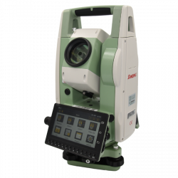
a-GEO 'Y' Android Γεωδαιτικός Σταθμός 2''
Με ενσωματωμένη την εφαρμογή πεδίου SurPro 6.0
Ο γεωδαιτικός σταθμός a-GEO 'Y' αποτελεί ένα πλήρες εργαλείο στα χέρια του μηχανικού. Είναι υψηλής γωνιακής και γραμμικής ακρίβειας 2'' / 2mm + 2ppm ανεξαρτήτως μεθοδολογίας μετρήσεως.
Ο a-GEO 'Y' διαθέτει λειτουργικό Android 11, ενώ φέρει προεγκατεστημένη μια από τις κορυφαίες εφαρμογές πεδίου παγκοσμίως, το SurPro 6.0 (διαθέτει ακόμα και μια πιο απλή εφαρμογή πεδίου με λιγότερες λειτουργίες).
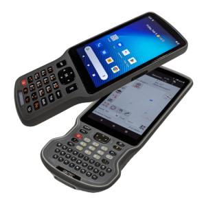
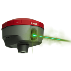
Συνοπτικά, ο σταθμός διαθέτει ατέρμονη κίνηση με χρήση ατέρμονων μικροβατικών κοχλίων, Laser Pointer & κέντρωση, διπλή μεγάλη φωτεινή οθόνη αφής 5.5', σκανδάλη γρήγορης μέτρησης, διπλό ψηφιακό αντισταθμιστή, θύρα USB, 4GB RAM και πιστοποίηση IP55.
Έξυπνο λειτουργικό Android
Χρησιμοποιήστε οποιαδήποτε εφαρμογή Cloud θέλετε, και μείνετε συγχρονισμένοι με το γραφείο.
Υψηλή απόδοση - ομαλή λειτουργία
Χάρη στον ισχυρό επεξεργαστή ARM Cortex και στην άφθονη μνήμη RAM, ο 'Υ' σας εγγυάται μια αξέχαστη εμπειρία χρήσης.
Μεγάλη συνδεσιμότητα
Bluetooth, USB, Type-C, 4G* (optional)
Άνετη λειτουργία και διαδραστικότητα
Μεγάλη φωτεινή οθόνη αφής 5.5' / 1280x720
Διάρκεια χρήσης
Με τη χρήση 2 μπαταριών μεγάλης διάρκειας, σε συνδυασμό με την έξυπνη κατανομή και εξοικονόμηση ενέργειας, θα βγάλει άνετα μια ολόκληρη μέρα μετρήσεων
Πανίσχυρο λογισμικό
Ο σταθμός διατίθεται με διπλό λογισμικό Android, το SurPro 6 (premium) και το BaseMeasure (βασική έκδοση)
Η χρήση του SurPro 6 προτείνεται για:
- τοπογραφικές αποτυπώσεις με ταυτόχρονη σχεδίαση στο CAD και τελική εξαγωγή πλήρους σχεδίου
- χαράξεις σημείων αλλά και οποιασδήποτε σχεδιαστικής οντότητας CAD απευθείας από αρχείο DWG
- εργασίες (αποτυπώσεις / χαράξεις) οδοποιίας, χωματουργικών κ.α.
Υποστήριξη πολλαπλών τύπων αρχείων εισόδου / εξόδου
Υποστηρίζεται ένα μεγάλο πλήθος τύπου αρχείων, όπως txt, csv, dxf, dwg, shp, xls, kml, kpz, gpx κ.α.
Γραφική χρήση
Χρήση CAD για αποτ΄ύπωση και χάραξη χωρίς να απαιτείται πλέον η ύπαρξη αυτοσχέδιου πεδίου (κροκί)
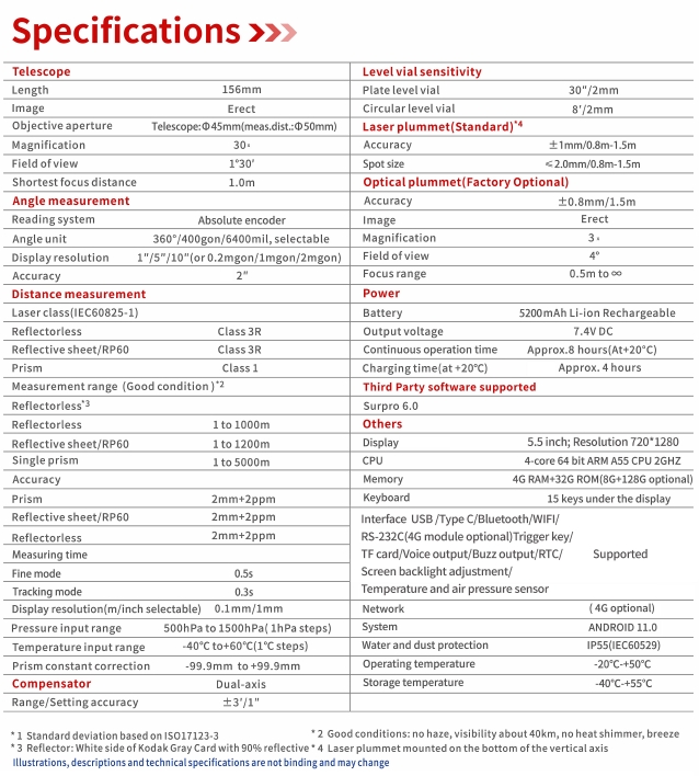
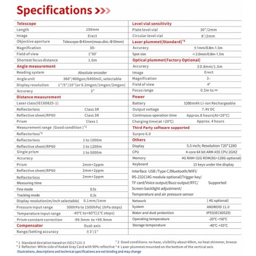
| Μέτρηση απόστασης | |
| Ακρίβεια μέτρησης | πρίσμα: 2mm + 2ppm | χωρίς πρίσμα: 2mm + 2ppm |
| Σε ανακλαστικό στόχο (5x5cm) | 1.0 μέτρo έως 1200 μέτρα |
| Σε πρίσμα | 1.0 μέτρα έως 5000 μέτρα |
| Σταθερά πρίσματος | Χειροκίνητη εισαγωγή / αυτόματη διόρθωση |
| Ταχύτητα μέτρησης | Μέτρηση ακριβείας: 0.5 sec Γρήγορη μέτρηση: 0.3-0.5 sec |
| Χωρίς πρίσμα | 1000m |
| Μέτρηση γωνιών | |
| Ακρίβεια | 2'' |
| Διάμετρος κύκλου | 79mm |
| Ελάχιστη ανάγνωση (διακριτότητα) | 0.5'', 1'', 5'', 10'' κατ'επιλογήν |
| Μέθοδος | Απόλυτη κωδικοποίηση |
| Σύστημα ανίχνευσης | 2 πλευρές οριζόντια & 2 πλευρές κάθετα |
| Υποστήριξη μονάδων | 360° / 400gon / 6400mil |
| Οθόνη | |
| Πληκτρολόγιο | Αλφαριθμητικό |
| Τοποθέτηση | 2 |
| Συνδεσιμότητα | |
| Σειριακή θύρα RS-232C | Για διασύνδεση με συσκευές που δεν υποστηρίζουν USB |
| Σύστημα | |
| Laser pointer | CLass 3 |
| Κέντρωση laser | CLass 2 |
| Λογισμικό | SurPro 6 |
| Μορφή εξόδου | txt, csv, dxf, dwg, shp, xls, kml, kpz, gpx, etc. |
| Σκανδάλη μέτρησης | NAI |
| Τηλεσκόπιο | |
| Διάμετρος στόχου | EDM | 50mm |
| Είδωλο | Ορθό |
| Εύρος θέασης | 1°30' |
| Μεγέθυνση | 30x |
| Μήκος | 154mm |
| Οθόνη | |
| Τύπος | Έγχρωμη οθόνη |
| Ανθεκτικότητα | |
| IP | IP55 |
| Θερμοκρασία χρήσης | -20℃ ~+50℃ |
| Θερμοκρασία συντήρησης | -40℃ ~+70℃ |
| Μπαταρία | |
| Παροχή ενέργειας | 2 μπαταρίες λιθίου DC 7.4V |


-250x250.png)

-250x250.png)
-250x250.png)
-250x250.png)
-250x250.png)
-250x250.png)
-250x250.png)
-250x250.png)
-250x250.png)
-250x250.png)

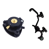
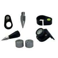
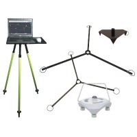
-250x250.jpg)
-250x250.jpg)
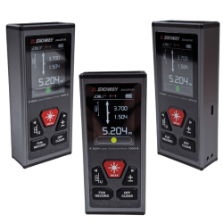









-250x250.png)
-250x250.png)
-500x500.png)
-500x500.png)
-500x500.png)
-500x500.png)
-80x80.png)
-80x80.png)
-80x80.png)
-80x80.png)

 Messenger
 WhatsApp
 Τηλέφωνο

-60x60.png)

-60x60.png)
-60x60.png)
.png)
-250x250.png)
-250x250.png)
-250x250.png)
-250x250.png)
-250x250.png)
-250x250.png)
-250x250.png)
-250x250.png)
-250x250.png)
-250x250.png)
-250x250.png)
-250x250.png)
