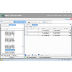
Άλλα προϊόντα του ίδιου κατασκευαστή
Αναλυτική παρουσίαση: Recap Survey/Diolkos λογισμικό οδοποιίας
To Diolkos είναι ένα ολοκληρωμένο και αυτόνομο λογισμικό σχεδιασμού οδών. Καλύπτει όλες τις περιπτώσεις οδοποιίας όπως αυτοκινητόδρομοι, επαρχιακές και αστικές οδοί, δασικές οδοί κλπ. Αντιμετωπίζει επαρκώς και με μεγάλη ευκολία σύνθετα οδικά έργα όπως κόμβοι, παράλληλο δίκτυο service road κλπ. Παράλληλα χρησιμοποιείται για διευθετήσεις χειμάρρων, παράλληλα υδραυλικά έργα κ.α.
Με το Diolkos μπορείτε ακόμα να κάνετε μελέτες οριοθέτησης - διεύθετησης ρεμάτων όπως και μελέτες τάφρων, καναλιών, διωρύγων κλπ. Οι μελέτες αυτές καλύπτονται πλήρως απο την προετοιμασία του υποβάθρου και τον υπολογισμό μοντέλου εδάφους μέχρι τις προμετρήσεις και τα κατασκευαστικά σχέδια.
►Όλες οι περιπτώσεις οδών κατά ΟΜΟΕ
►3D γραφικά σε πραγματικό χρόνο
►Δημιουργία & διαχείριση ψηφιακών μοντέλων εδάφους
►Έργα πολλών οδών
►Προμετρήσεις - Επιμετρήσεις
►Αυτόματη παραγωγή As-built σχεδίων
►Μοντελοποίηση και μελέτη ανοικτών αγωγών
►Οπισθοτροχίες
►Υποστήριξη από μηχανικούς
►Δυνατότητα συνεχούς εκπαίδευσης
Σχεδιασμός Οδών με το λογισμικό οδοποιίας Diolkos
- Εύκολη και γρήγορη εισαγωγή και τροποποίηση της γεωμετρίας του έργου. On line προοπτική απεικόνιση οδικών έργων (απλών και σύνθετων), εικονική κίνηση σε πραγματικο χρόνο κατα μήκος της χάραξης για έλεγχο της ορατότητας.
- Μελέτη διαγραμμάτων επικλίσεων, διαπλατύνσεων, ταχυτήτων V85, στραγγιστικής στρώσης.
- Ανάγλυφο εδάφους απο τρίγωνα (ΤΙΝ) ή 3D γραμμές ( π.χ. ισοϋψείς). Τύχουσα γεωμετρία πρανών ορυγμάτων και επιχωμάτων. Μελέτη αναβάθμισης υφιστάμενης οδού.
- Υπολογισμός στραγγιστικής στρώσης, Σ.Ε.Ο./Ι.Β.Ο., αναβαθμών αγκύρωσης, εξυγίανσης εδάφους, τοίχων αντιστήριξης, στηθαίων ασφαλείας.
- Εποπτικός γραφικός ορισμός τυπικών διατόμων τύχουσας μορφής. Ελέυθερη αντιστοίχηση υλικών. Βιβλιοθήκη τυπικών διατομών κατά ΟΜΟΕ.
- Ταχύτατος υπολογισμός διατομών σε κάθε τροποποίηση της χάραξης και αυτόματος υπολογισμός του τελικού 3D μοντέλου εδάφους- οδού.
Κατασκευή Οδών με το Diolkos - Λογισμικό Οδοποιίας
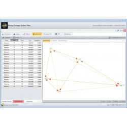
- Εύκολη εισαγωγή μετρήσεων πεδίου απο Total Station ή GPS με αρχεία κειμένου. Το πρόγραμμα παράγει την οριζοντιογραφία, την μηκοτομή και τις διατομές του δρόμου από τα τοπογραφικά σημεία που μετρήθηκαν στο πεδίο.
- Εξαγωγή τρισδιάστατων σημείων σε αρχείο κειμένου για την πασσάλωση στο πεδίο. Ο χρήστης μπορεί να εξάγει τις συντεταγμένες οποιουδήποτε σημείου της διατομής σε αρχείο μορφής (Χ,Υ,Ζ). Μπορει επίσης να οριστεί το format εξαγωγής ώστε να μπορεί να φορτωθεί έυκολα στον σχετικό εξοπλισμό.
- Ευέλικτη εισαγωγή των δεδομένων πεδίου
- Μοντέλο δρόμου απο σημεία αποτύπωσης
- Υπολογισμός ορυγμάτων, επιχωμάτων, φυτικών γαιών
- Εύκολη τροποποίηση των γραμμών των διατομών
- Εξαγωγή στοιχείων για χάραξη στο πεδίο
- Δημιουργία "As Built" σχεδίων
- Παραγωγή των "As Built" πινάκων ποσοτήτων







-250x250.png)

-250x250.png)
-250x250.png)





-250x250.png)
-250x250.png)
-250x250.png)
-250x250.png)
-250x250.png)
-250x250.png)
-250x250.png)









-250x250.jpg)
-250x250.jpg)









-250x250.png)
-250x250.png)

 Messenger
 WhatsApp
 Τηλέφωνο


